UK NHS Integrated Care Systems (ICS's) Februiary 2023 for England, Scotland, N.Ireland and Wales in Vector Editable File Formats and KML or Shapefiles
UK NHS Integrated Care Systems (ICS's) Februiary 2023 for England, Scotland, N.Ireland and Wales in Vector Editable File Formats and KML or Shapefiles
Our vector files provide the flexibility to easily edit and manipulate the boundaries of the NHS ICS map to meet your specific needs. Whether you're creating a map for a presentation or report, our vector files can be customised to meet your requirements. Our files are also compatible with a wide range of software applications, including Adobe Illustrator, PowerPoint, ArcGIS, QGIS and more, making it easy for you to create professional-quality maps.
In addition to our customizable vector files, we offer a user-friendly tool that enables you to create and customise an ICS NHS map without any prior experience. Our tool is designed to be easy to use and provides you with the flexibility to create maps that meet your specific needs without the need for traditional graphics editing software.
We understand the importance of accuracy when it comes to maps. That's why we ensure that our vector files are up-to-date and reflect the most recent changes to the NHS ICS boundaries. We believe that high-quality maps should be accessible to everyone, which is why we offer our maps at competitive prices. You don't have to break the bank to get the maps you need for your work or research.
Our integrated care systems boundary maps come as vector editable files which can be opened in Adobe Illustrator, inkscape or PowerPoint. You also receive svg images which can be imported into office documents and even linked to in Excel(ONLY if you have expertise in this area).

This is just a vector snapshot of part of the whole UK ICS map. It shows the ICS boundaries of East of England . It's an svg image so no matter what level of zoom or scale it is printed, it will not lose any resolution. Copy and download the image below and try editing or printing it to see for yourself.
We've created a small bundle of files available to download completely free of charge below.
GIS Files Sample DownloadWe have the ability to attach additional data to the NHS ICS boundaries, which can provide deeper insights into the health and social issues that affect different populations. This data can be used to plan and evaluate healthcare services and programs, and can be customised to meet your specific needs.
We have a lot of data in-house that we can attach to our gis-files or you can download data yourself from the NHS data site or you may have aditional data of your own.
We can also run geographic analysis of your data. e.g. Plot 10,000 postcodes on an NHS ICS map and calculate how many postcodes points exist within each ICS polygon. Then produce a heat map to show the level of densities across a whole UK ICS map.
Contact us today to learn more about how we can add data to our customizable GIS files for your research or project.
Raster images are made up of pixels, while vector images are made up of lines and shapes. Raster images are best for photographs, while vector images are better for cartographic features such as roads, rivers, and political boundaries. Vector images are more flexible, scalable, and precise than raster images, making them ideal for map design. Additionally, vector images tend to have smaller file sizes and can be read by screen readers, which is important for creating accessible maps.
Printing, Laminating and Sign or Whiteboard printing of our ICS - Integrated Care Systems Map
We offer the flexibility to print any of our maps in various sizes, whether you require a laminated poster map, A4 printed maps, deskpads, or office wall maps printed onto a whiteboard or magnetic board. Our team can create the maps you require and transfer them onto different printed media, at a faster rate and a lower cost than you may have initially anticipated.
When it comes to large maps, you want to make sure they are not only accurate but visually appealing as well. That's why our glossy laminated A0 sized maps are the perfect solution for your mapping needs. Not only do they showcase your maps in the best possible light, but the laminated finish ensures they are protected from wear and tear, making them durable for years to come. Whether you're using them for educational purposes or displaying them for business, our maps will grab people's attention and help you communicate your message effectively. So don't settle for mediocre maps when you can have stunning, professional-quality maps that are built to last with our laminated A0 sized maps.

| Size | Laminated | |
| A2 | £35.00 | |
| A1 | £46.00 | |
| A0 | £62.00 | |
| Size | Non-Laminated | |
| A2 | £22.00 | |
| A1 | £30.00 | |
| A0 | £44.00 | |
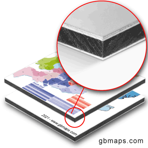
When it comes to displaying your maps, you want something that's not only visually appealing but also durable enough to withstand the elements. That's why our 3mm thick rigid dibond panels are the perfect solution for your mapping needs, whether you need them for indoor or outdoor use. These panels are weather-resistant and UV stable, so they won't fade or degrade even with prolonged exposure to sunlight or harsh weather conditions. Plus, they are made with a lightweight yet sturdy aluminum composite material that makes them easy to hang or display. With our rigid dibond panels, you can showcase your maps with confidence, knowing they will look great and last for years to come.

| Size | Cost | |
| 120 cm x 240 cm | £274.00 | |
| 80 cm x 120 cm (A0) | £148.00 | |
| 60 cm x 40 cm | £66.00 | |
| 80 cm x 60 cm | £82.50 | |
| 50 cm x 50 cm | £74.80 |
All the above can be contour cut to any shape required.
Call or message us today to talk about your project. Tel 01751 473136 or Contact Form