December 2023 UK NHS Area Prescribing Committees (APC's) for England as Vector Editable FIle Formats
December 2023 UK NHS Area Prescribing Committees (APC's) for England as Vector Editable FIle Formats
We've compiled a full England Vector Map consisting of the English NHS APC (Area Prescribing Committee) Map
Area Prescribing committees are groups of GP’s pharmacists and other key healthcare professionals that identify and promote the appropriate use of medicines across clusters of CCG’s.
Each boundary is made up of multiple CCG's and is individually editable. Purchasing this bundle of files would be useful for editing in Adobe Illustrator or PowerPoint or some similar package then using that map in publications or presentations.
On this map we have grouped all the CCG's of England into their appropriate APC clusters. We've then dissolved the boundaries of each of those clusters and this gives us the geographical APC boundaries. These aren't official GIS NHS boundaries but more derived boundaries which we have created from the latest revision of the UK CCG Boundary map.
We can also supply the GIS .SHP shapefiles of all the APC boundaries as a whole or individually. We can also supply the boundary files as KML or GEO-JSON files, Just get in touch and we'll work something our.
We've created a small bundle of files available to download completely free of charge below.
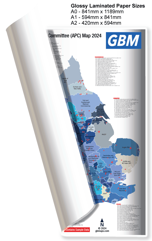
Our wall map poster prints, finished with a high-gloss laminate, are of unparalleled quality, truly representing the pinnacle of printing excellence. The process begins with printing the maps onto a premium 130gsm photo paper at an exceptionally high resolution. This step ensures every detail is captured with utmost clarity. Following this, both sides of the print are laminated, resulting in a fully encapsulated and durably protected map.
Upon arrival, you’ll find these prints neatly rolled in a triangular tube(You did hear that right!). Their semi-rigidity gives them a unique 'flexible wobble board' appearance and feel as they spring out. Their practical design allows for easy writing with whiteboard markers, which can be effortlessly wiped clean, making them both interactive and reusable. Additionally, mounting them is a breeze – a few pins or sticky pads are all you need to affix these stunning prints to your wall.
The quality of these prints is so remarkable that I often find myself wishing for more wall space just to display them!

| Size | Laminated | |
| A2 | £35.00 | |
| A1 | £46.00 | |
| A0 | £62.00 | |
| Size | Non-Laminated | |
| A2 | £22.00 | |
| A1 | £30.00 | |
| A0 | £44.00 | |
Our maps are meticulously crafted using vector graphics, ensuring that they can be scaled to any size while maintaining their crisp, clear quality without any pixelation or loss of resolution. This feature is especially advantageous if you're considering a grand display, such as an extra-large panel for your office or boardroom wall.
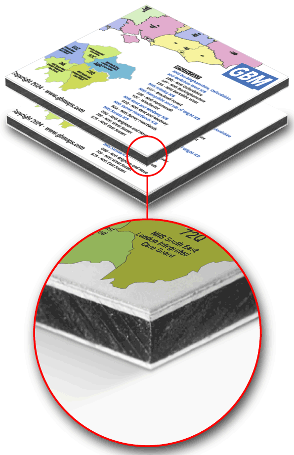
We specialize in printing directly onto Dibond, a robust 3mm thick aluminum composite material, followed by the application of a glossy laminate to enhance and protect the map's surface. Our printing capabilities extend to single panels of up to 2400mm x 1200mm. For larger wall coverings, these panels can be expertly mounted side by side. Thanks to their precisely cut square and straight edges, the seams between adjacent panels are nearly invisible, creating a seamless and continuous visual display.
Rest assured, we can accommodate any size requirement up to these dimensions in a single sheet, offering you a versatile range of options for your unique space.

| Size | Cost | |
| 120 cm x 240 cm | £274.00 | |
| 80 cm x 120 cm (A0) | £148.00 | |
| 60 cm x 40 cm | £66.00 | |
| 80 cm x 60 cm | £82.50 | |
| 50 cm x 50 cm | £74.80 |
All the above can be contour cut to any shape required.
There are 266 Individual CCG areas Across England and these are clustered into the 67 APC Groups shown in our APC maps. We also include a basic excel spreadsheet showing which CCG belongs to which APC.

Vector map file formats offer superior versatility for mapping compared to raster images like .jpg or .png. Unlike raster images, vector files, created using coordinates and attributes, allow for detailed editing post-creation. They are compatible with various software, including Adobe Illustrator and Inkscape, and some are free to use. A key advantage of vector maps is their scalability without losing resolution, maintaining clarity even when enlarged to substantial sizes, such as a bus, unlike raster images that can become pixelated.
Call or message us today to talk about your project. Tel 01751 473136 or Contact Form